Geography of Mesopotamia
- Crops were grown in areas that became very fertile from regular flooding since they were near the river
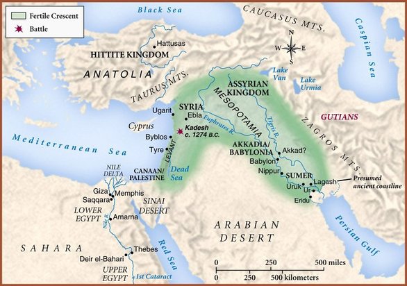
- Mesopotamia was located in the Fertile Crescent which was between the Tigris and Euphrates river
- The Fertile Crescent extends from the Persian Gulf to the Mediterranean Sea
- Northern Mesopotamia is a plateau bordered on the north and east by mountains
- Southern Mesopotamia was a flat plain that had the Tigris and Euphrates rivers flowing into it from the hills
- Every year when the Tigris and Euphrates flooded, it brought lots of silt (a mixture of rich soil and tiny rocks) to the land which was great for farming
- Mesopotamians dug large rain basins to catch water that fell from the north
- They also dug canals to connect these basins to a large network of ditches

